Category Archives: protected bicycle lanes

Where are We in Albany?

FROM THE ARCHIVES: The following was one of the Albany Bicycle Coalition’s many efforts to promote the installation of bicycle lanes on Madison Ave. as part of the Madison Avenue Traffic Calming campaign. While we were successful in that effort, only about 1.6 miles of additional bicycle lanes have been installed in the City of Albany since the lanes on Madison Ave. for a grand total of 4.9. Thus, the basic message below remains as relevant as it was 7 years ago. If you believe otherwise, please comment.

++++++++++++++

“Sharrows are shared lane advisory markings, not bike infrastructure.”[1]

“Purpose – The purpose of this memorandum is to issue an Interim Approval for the optional use of green colored pavement in marked bicycle lanes and in extensions of bicycle lanes through intersections and other traffic conflict areas.  Interim Approval allows interim use.”[2]

Where are We in Albany?

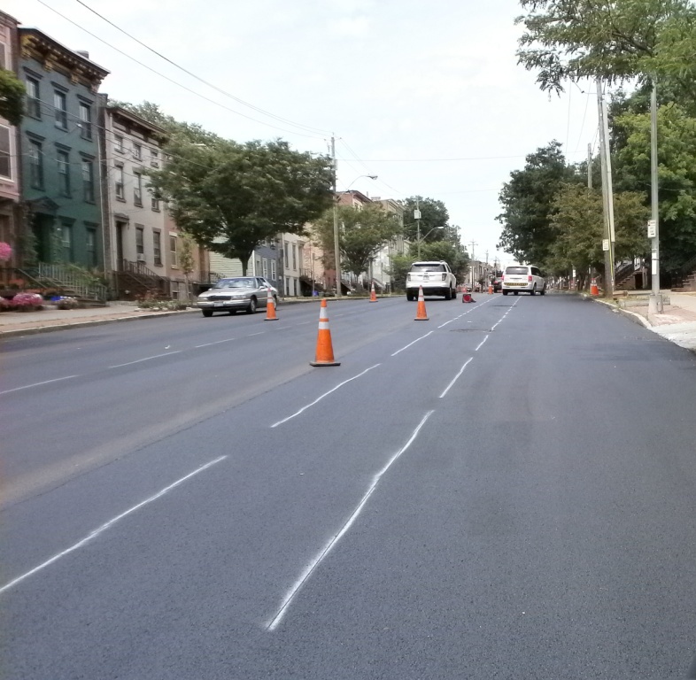
Why Settle for Less?  – The question before us all is: are we happy with the “same old-same old” or do we want to move Albany into the present?  If cyclists do not push for change in this direction, who is to do so?  Where is the “transportation equity” in that?  The cycling changes made in Albany to date are “bicycle amenities” not “bicycle infrastructure,” ‘bicycle routes,” or “bicycle boulevards.”  So far, we have installed one set of bicycle lanes just under a mile in length that begins nowhere and ends nowhere on a street that many people will not even drive on (much less cycle). [ED Refers to the Clinton Ave. 1.7 miles of bicycle lanes completed in 2008.]

Albany can make itself bicycle friendly to its residents, commuters, and tourists.  As an old, established city, everything is compact and accessible.  The terrain is bicycle friendly.  Instead of a grid of semi-highways, Albany has a network of curving streets, “T” intersections, and multiple routes to many destinations.   

Not Infrastructure – From observations and from the literature, shared lane markings are merely an advisory; they definitely are not infrastructure.  Putting in a shared lane is analogous to putting up a “yield to pedestrians” sign instead of a crosswalks, traffic lights, speed “humps,” and so on.

What Do Shared Lanes Accomplish?  – There is some modest consciousness raising for both cyclists and motorists, but that is about the contribution.  Their success is still largely dependent on the patience and courtesy of motor vehicle drivers. 

Of course, shared lanes are simpler.  Doing nothing is even more so.  Simplicity is not the goal – the goal to encourage cycling.  The goal is to get people out of cars and onto bicycles.  The goal is to spend Albany’s street “paving” dollars to benefit all the users – that is why Albany passed a complete streets ordinance on 6/3/13.

Other East-West Routes?  – As far as splitting the protected east-west bicycle route between Washington Ave. and Madison Ave., it is not clear how this would work or why one would want to do it.  Again, for the hesitant cyclists, Washington Ave. is a road to nowhere.  What to does one do at Brevator?  What does one do at the flyover?  These are not bicycle-friendly routes.  Added to this is the intrinsic high-speed nature of Washington Ave. for almost its entire length west of Robin St.

The manifold benefits of Madison Ave. as the main east-west bicycle route include the following:

  • Its locus for many destinations
  • Direct route to lower Albany and the Mohawk-Hudson Bike-Hike Trail (and later the Albany County Rail Trail)
  • Its connection to Western Ave. – which, one day, will be reconfigured with bicycle infrastructure.
  • None of these features is shared by the other candidates – Washington Ave., Central Ave., or the combined Clinton Ave. /Central Ave.

Buses And Protected Lanes – The issue of bus/protected lanes interface can be solved, just as it has been solved elsewhere.

Shared Lanes Do Not Help – Shared lance markings do little to encourage hesitant cyclists to take to the streets.  Would you put your 8-year-old child on Delaware Ave.?  We cannot base our opinions and recommendations on what makes us feel comfortable on the road or what changes would satisfy us but on what we believe will get those who are not currently riding the streets to get them out into the bicycle lanes and onto the protected lanes – and keep them there until they too can say “well, I guess I could try riding in traffic without special bicycle accommodations!”

Now, Madison Ave. –

  • If not this, What?
  • If not now, When?
  • If not us, Who?

This leaves us with the question – what to do with Madison Ave. (given that it will have the proposed 2 motor vehicle lanes, 2 parking lanes, and one central turn lane)? [ED: Between 2016 and 2018, the City of Albany chose it install 1.6 miles of un-buffeted, conventional bicycle lanes on Madison Ave. instead of the preferred protected bicycle lanes. The city chose to keep the wide motor vehicle travel lanes (vs. the 10-foot lanes recommended. The alternatives under consideration in 2013 were as listed below.]

These would be the alternative proposals for Madison Ave.:

  1. Two curbside protected bicycle lanes by either eliminating one lane of parking or by narrowing the 5 motor vehicles lanes.  The protected lanes could be 9 or 10 feet wide.  This configuration would be “bicycle/no parking/travel/turn/travel/parking/bicycle” with dimensions of either 10-0-10-10-10-7-10 feet or 9-0-11-10-11-7-9 feet. 
  2. Two 6-foot (not 5-foot) bicycle lanes and three 10-foot motor vehicle lanes (this now would be “Alternative 1, Option C-2”).[3]  The current “alternative 1, Option C calls for a “parking/bicycle/travel/turn/travel/bicycle/parking” configuration of 7.5-5-11-10-11-5-7.5 feet.  The proposed C-2 would be 7-6-10.5-10-10.5-6-7.  Narrowing the two travel lanes to 10 feet would allow for 6.5-foot bicycle lanes – almost European.

[1] Pg. 25, Momentum, Aug-Sep 2013

[2] SOURCE: Manual on Uniform Traffic Control Devices – http://mutcd.fhwa.dot.gov/resources/interim_approval/ia14/index.htm

[3] The lane widths on Western Ave. (between Pine and Allen) are 10-10.5-10-10 feet with no parking lane.  The lanes on Madison Ave. between W. Lawrence and Main Ave. are 7-10-11-11-10-7 feet.  Those on Madison Ave. east of the College of St. Rose “bump outs” are 19.5-10-10-19.5 with no marked parking lane.  (Allowing for a 7-foot parking lane, the configuration would be 7-12.5-10-10-12.5-7.)  Source for alternatives is the “Madison Ave. Road Diet Feasibility Study,” 4/16/13.

Allen/Madison/Western – Yikes!

Leave a comment

Filed under Albany-Bike/Ped Master Plan, Bike Lanes, Editorial, Equity, protected bicycle lanes

Jewel in the Crown?

***UPDATE***

Alert cyclist Brent noted that the bicycle ramps have had a entry ramp added – see picture: bike-ski-11-28-16-crop


Back-story – The revitalization of the Corning Riverfront Park proceeds apace. The “finishing touches” are nearing completion. The new “green path” is open or will be soon so that people on bicycles can ride from the Slater to the Barge/DGS building without having to navigate amongst the walkers, joggers, and strollers. At Colonie/Water Sts., a second segment helps riders get clear of the Corning Riverfront Park and across the I-787 exit ramp. [Ed: Be careful here!]

Alert cyclist Brent reported that bicycle ramps are installed on the stairs leading to and from the Corning Riverfront Park over the bridge that crosses I-787 at Pine St. on Broadway. Now, instead of carrying one’s bicycle up or down the stairs, one can walk it up or down the ramp. As a cautionary note, lean your bicycle away from the hand railing to prevent interference with the pedals.

OLYMPUS DIGITAL CAMERA

The ramps help those whose bicycle weight or degree of fitness makes climbing/descending the stairs a chore. In addition, those who want to enter the Corning Riverfront Park WITHOUT risking the Jose Perez Memorial Plaza (at the Slater entrance) or the I-787 off ramp (at Colonie St.) or who are in midtown, can now use the pedestrian bridge (with ramps) as a good alternative. Notabley, people on bicycles can access the Corning Riverfront Park from either end by using the BikeAlbanyMap. OLYMPUS DIGITAL CAMERA

The ramps are a good idea. Nevertheless, check the motorized “bicycle lift” in Trondheim – a good idea for the  State or Morton St. hills?

1 Comment

Filed under Bike Lanes, Bike Tech, Corning Riverfront Park, protected bicycle lanes

Protected Bicycle Lanes in Albany?

Protected Bicycle Lanes in Albany?

You saw it here first – under construction (photo #1). Hopefully those “Jersey Barriers” are an indication of the final Quay St. configuration (looking north just north of the USS Slater).

OLYMPUS DIGITAL CAMERA

#1 – PBL in Albany?

The Corning Riverfront Park Project will include the following according to the City of Albany:

  • Repaving and widening some areas of the multi-use path along the riverfront to accommodate two-way cycling as well as people walking.
  • Extending the multi-use path south to the Quay St. /Broadway intersection near the USS Slater (The Jose Perez Memorial Plaza) and north to Erie Blvd. (ed: Now if we can just build that South End Bikeway Link … )
  • Building a new two-way bicycle lane along the backside (west side) of the tidal ponds to bypass the amphitheater during events (photo #2 – tiptoe around the tidal pool looking south from near park HQ) .
  • OLYMPUS DIGITAL CAMERA

    #2 – Path for People on Bicycles West of the Main Park Area

  • Making the riverfront more accessible with new crosswalk signals at three intersections on Quay St. at Broadway, the Broadway Connector, and Water St.
  • Calming Quay Street to make it a “complete street.” Quay St. will go from two motor vehicle lanes to one to accommodate people on bicycles and people walking as well as motor vehicles (photo # 3 – Quay St. gets a shave – looking north from just past the pump station/former Aqua Duck HQ).

    OLYMPUS DIGITAL CAMERA

    #3 – Quay St. Gives Up a Motor Vehicle Lane to People

  • Adding nearly 50 parking spots on Quay St. to make it easier for people in cars to visit the riverfront.
  • Enhancing lighting along the new multi-use paths and along Quay St.
  • Providing benches, bicycle racks, and trashcans (ed.: recycling too?) along the paths.
  • Providing informational kiosks to promote Albany events and activities.
  • Adding trees to the park so that there will be more trees than before the project began.

Moving on (after a visit to the Corning Riverfront Park) – photo #4 shows markings for the return of Conventional Bicycle Lanes on the repaved Clinton Ave. Maybe the bicycle lanes can at least begin continued beyond Lexington to the intersection of Clinton and Central Aves. per the original plan.   As of 7/11, the lanes are re-marked from Ten Broeck to the western end of the re-paving project – you’ll notice the lane marking bicycles are now rider less.  Hmmmmm…

OLYMPUS DIGITAL CAMERA

Markings for Bicycle Lanes – looking west

Leave a comment

Filed under Corning Riverfront Park, protected bicycle lanes, South End Bike Link

Celebrating Trails in the Area – Not Once But Twice in the Same Issue of the Times Union!

South End Bikeway LinkCelebrating Trails in the Area – Not Once But Twice in the Same Issue of the Times Union!

Letters in the Albany Times Union – 4/17/16

#1 – Erin Walsh wrote about the Uncle Sam 3.1-mile paved rail-trail that runs through North Troy and Lansingburgh. She reported renewed interest in the trail, highlighting its value to the immediate community and the greater Capital Region. She noted that Capital Roots, Transport Troy, the National Park Service, Troy Bike Rescue, and Troy city have all taken an interest in the trail’s renewal.

You’ll have a chance to –

  • do trail cleanup on 4/23
  • join a community bike ride on 5/22
  • take a historical and nature walk on 6/4
  • join a community bike ride on 9/24 – the famous “Collar City Ramble”

Erin is an enthusiastic supporter of complete streets and other pro-pedestrian/cyclist initiatives in Troy and the Capital Region. Contact

++++++

#2 – For those who choose not to read the paper paper, you’ll miss the wonderful map of the South End Bikeway Link created by local artist and bon vivant, Frank Smith. I hope that you’ll soon be seeing this map elsewhere in the City of Albany.

In any case, the illustrative map highlights better than words the essence of this second letter – a call for immediate completion of a safe and protected connecting link between the Albany County Helderberg Hudson Rail Trail trailhead on S. Pearl St. and the \southern terminus of the Mohawk-Hudson Bike-Hike Trail at the Slater/Dutch Apple moorings.

Under city contract, Alta Planning + Design is conducting a feasibility/design study of this critical 1.3-mile link. Stay alert for meetings hosted by the city and Alta.

Just think – Voorheesville to Buffalo on an (almost) continuous trail!

Leave a comment

Filed under Activism, Albany County Rail Trail, Erie Canal Trail, protected bicycle lanes, South End Bike Link

Protected Bicycle Lanes at Risk on Madison Ave.

Protected Bicycle Lanes at Risk on Madison Ave. – After a 10-year effort by citizen groups, the City of Albany is designing and constructing a “road diet” along Madison Ave. from S. Allen St. to Lark St. While the project reduces the number of motor vehicle travel lanes, while improving to some degree bicycle accommodations, it still maintains Madison Ave. as a car-priority street.

The City of Albany is holding a Public Meeting on Madison Ave. Traffic Calming and Protected Bicycle Lanes on Wednesday, March 9, 6:30-7:30 PM at the College of St. Rose, Lally School of Education, 1009 Madison Ave.

The City of Albany initially proposed three alternative treatments:

  • Shared Motor Vehicle/Bicycle Lanes
  • Shared Motor Vehicle Parking/Bicycle Lanes
  • Conventional Bicycle Lanes

OLYMPUS DIGITAL CAMERA

5-ft lane with buffer

Since no one of these, especially the first two “non-facilities,” were acceptable, the Protected Bicycle Lane Coalition formed to push for a 2-way Protected Bicycle Lane on the north side of Madison Ave. The city studied this proposal and added a fifth option, Buffered Bicycle Lanes. The Protected Bicycle Lane Coalition then offered a second Protected Bicycle Lane option, 1-way Protected Bicycle Lanes on each side of the street.

The City now has two alternatives under consideration. The purpose of the meeting is to review these concepts and trade-offs for the two feasible alternatives. The Allen St.-to-Lark St. project is to be done in three phases, Allen to Partridge Sts. being the first.

tumblr_loptfhMnk81qzu3e6o1_1280

Meeting Details:

  • Wednesday
  • March 9, 2016
    6:30 to 7:30 PM
  • Info/questions? Bill Trudeau Jr., Coordinator of Traffic Engineering, Albany Traffic Engineering Unit, 434-5791, MadisonAveStudy@albany-ny.org
  • The College of Saint Rose – Lally School of Education, 1009 Madison Ave., Touhey Forum
  • March 9, 2016

Leave a comment

Filed under Activisim, protected bicycle lanes