The approaching spring weather suggests that trips to the nearest multi-use path are in the near future. With that in mind, it’s time to remind ourselves that multi-use means just that – people will be there with a multiplicity of modes of transport ranging from babies in carriages to mobility devices to road warriors on carbon-fiber bikes. It is a good time to review some of the appropriate protocols or rules for using a multi-use path.
The very first one and probably the most important to both walkers/joggers and cyclists is to keep to the right. Sometimes walkers are confused since they were raised to walk on the left side facing traffic. However, that is on a road or street with no sidewalks. A multi-use path is not a roadway so walk on the right and ride on the right.
Here are some other tips:
Walkers –
It’s great to walk in twos or threes for the social benefit, but keep in mind the need to move to the right into single file to allow faster moving traffic – generally bicycles, skaters and joggers – to pass safely by.
As needed, just move to the right trail edge. Don’t scatter in different directions, and divide to different sides of the path or stand still in the middle like a bunny in the headlights!
Stay alert to what is behind you.
Small children and dogs on leashes need to be kept under control for their safety and for the safety of others on the trail. This is especially true when a dog is on a retractable lead as it allows the animal to range across the trail forming a barrier.
Cyclists –
The main rule is to be aware that you are traveling faster than other trail users. You are obligated to extend courtesy to them as you pass by.
Always signal your presence by ringing your bell, calling out, or clearly indicating you’re passing on the left – “on your left!”
Avoid startling those being overtaken.
Always yield to pedestrians and mobility devices – no exceptions.
If traveling two or more abreast, be prepared to single up when overtaking other path users, approaching other users, or when being overtaken by faster riders.
Experienced riders who are out on training rides must remember that the multi-use path is not a racetrack and that you put yourself and others at risk by riding at speeds that are far in excess of all other users. Nobody wants to get hit by the combined weight of cyclist and bicycle moving at any speed – especially if the rider is using a peddle assist bike with the added weight of a battery, motor, heavier frame, etc.
If you need high speed training rides, choose the appropriate time and place.
Both Walkers and Riders –
If stopping, get off the trail to allow others to pass by.
At dusk and in the dark, have a light front and rear.
Bring out any trash you bring to the trail (plus a little more if you can). Take it with you or deposit in appropriate container when you leave.
Those who bring dogs need to clean up and discard or carry out any “by-product.”
If you reach the trailhead by a motor vehicle, park where indicated and ensure that your vehicle is not blocking another.
If you come across someone having difficulty, check to see if you can offer needed assistance.
Stay off private property. Be courteous to local residents and respect their property.
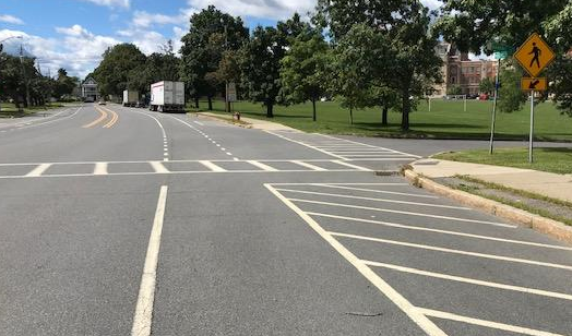
Concerned Town of Colonie residents and cycling/walking advocates are pushing for a multi-use path from the British American Blvd. bike lanes at Rt 7/Troy-Schenectady Road, across River Road to the Mohawk-Hudson Bike-Hike Trail (MHBHT). This path would provide a safe connection for bicycles and pedestrians and avoid the hazardous current route along Route 7 and Rosendale Road. It’s the missing link in the CapitalNYBikeMap UAlbany-to-Lions-Park route (see map below); it’s a strategic component of the Capital District Trails Plan’s “Shaker Trail” (page 33); and it will link directly to Colonie’s extensive Ann Lee/Shaker trail system and the airport. For a detailed analysis of why this path is vital, read David Pratt’s letter below, following the map. See also: Times Union 02-12-22 and Save Colonie’s campaign
The Ask – To support this project, please write to or email both the Town of Colonie supervisor and the planning director at:
The Honorable Peter Crummey, Supervisor Town of Colonie Colonie Memorial Town Hall 534 New Loudon Rd. Latham, NY 12110-0508
The UAlbany-to-Lions-Park route is a ten mile on- and off-road trail, providing a strategic north-south link across the I-90 / Central Ave. corridor. Commencing at Western Ave. / UAlbany, it eventually reaches the intersection of British American Blvd. and Route 7, as shown in blue on the map below. At that point the route becomes hazardous, as shown in red at the top. The proposed safe connection to MHBHT, under discussion, is shown in green.
Click the map to display it full-screen in a new tab.
David Pratt is a Town of Colonie resident and regular user of the trail. Mr. Pratt presented a statement at the Town of Colonie Planning Board Meeting on January 25, 2022 the text of which follows below.
++++++ DAVID PRATT LETTER TEXT ++++++
Dear Town of Colonie Planning Board,
My name is David Pratt. I would like to offer the following remarks. These remarks reflect my views only and not necessarily those of the multiple organizations that have signed the attached letter dated January 10, 2021.
I live on River Road approximately 1 mile east of the Northview Development. The Empire State Bike Trail (a.k.a. Colonie bike path, multi-use trail, Mohawk-Hudson Trail, Mohawk River hike & bike trail etc.) is 65 yards from our front door. Like hundreds of other town of Colonie residents, I love this bike path. I am grateful for it each and every time I go out for a run, bike ride or walk my dog. I also firmly believe it adds to the resale value of my property.
I share many of the concerns of my neighbors on Buhrmaster Rd., River Road, and in the Northview development who stand in opposition to this proposal by Keeler Motor Car Company. I agree that a road connecting Keeler motors to River Road would be dangerous and detrimental. This should not be part of the approved plan. River Road has already effectively become “alternate Route 7.” There is heavy traffic every rush hour on this rural and scenic road. There is also rampant speeding and littering that accompanies this overuse. So while I oppose a vehicular connection between the Keeler complex and River Road, a connecting bike and pedestrian trail is an entirely different matter and I think it is a great idea that, by itself, will not unduly harm my neighbors.
The purpose of my attendance here tonight is to submit into the public record a letter jointly created by several local public interest groups. We who have signed this letter believe that any approval of this Keeler Motorcar Company proposal should only be approved by this Planning Board if it includes the creation of a bike path similar to the one graciously proposed by Keeler in their initial proposal.
This Board must weigh the benefits and costs of any development of the Keeler property amongst all the stakeholders. The stakeholders include Keeler, Northview and River Road neighbors, and most importantly, the Town of Colonie citizens who this Board proudly represents. Reasonable compromise is required of all parties. I am confident that a satisfactory compromise will be worked out by this Board.
Any reasonable compromise for the Keeler expansion should include a connector bike/walking trail. My neighbors are correct to raise concerns about traffic, congestion, runoff, noise, and even light pollution. Their concerns should be addressed and ameliorated to the greatest extent possible. However, I part with my neighbors in their reported opposition to the bike/pedestrian connector trail that was part of the initial development proposal. The neighbors’ concerns do NOT preclude the creation of a bike path. Compromise is possible here. Unfortunately, the specific objection to the bike path proposal is a textbook example of the NIMBY (not in my backyard) response. It pits the objection of a very small group of neighbors against the overall benefit to a public group hundreds of times larger. Mr. Neidl’s 6/2/21 letter disparages what he called “various special interest groups” who for years have advocated for this bike-path connector. Indeed, many thoughtful planning committees over the years have advocated for this connecting trail. Their interest was the overriding public good that this linkage would contribute, not selfish “special interests.” In truth, the only “special interest group” being represented here tonight is Mr. Neldi’s clients who wish to block a safe bike trail connector. I urge this group to reconsider their opposition and work with us for a reasonable compromise.
This bike trail is needed to safely link the existing Mohawk River bike path to the existing British American Blvd./Watervliet Shaker Road bike path. This current path provides access to the Airport, Shaker Heritage Society, and Anne Lee Pond. Additionally, newly constructed bike and pedestrian lanes along Albany Shaker Road stretch this path all the way to the Desmond hotel, not terribly far from the Colonie Town Library and even The Crossings Town Park. It would be great to link these public assets together. Can someone please remind me of the exact millions of taxpayer dollars spent on the very pretty but under-used path bridge that crosses Watervliet Shaker Road near the airport? Should this path dead end on the treacherous Troy Schenectady Road as it does now? How many millions of dollars were spent on the exciting new Empire State bike trail that now safely connects Buffalo and Albany? The distance between these two trail networks is only several hundred yards. How does it not make perfect sense to have a safe connection between these two public assets? There is an obvious synergy to leveraging these two expensive projects together for the benefit of all users. Most of these users are constituents of this very Board that I stand in front of.
Peter Crummey is beginning his term as Town Supervisor. One of the most popular planks that he ran on was his promise of enhancing the town of Colonie’s parks and recreational opportunities. In his January 1st interview with WAMC, he made special reference to improving the town’s recreational facilities and parks along the Mohawk River. This bike path connector would do exactly that and would be a win for him and for everybody who enjoy these bike paths.
This connector would also benefit businesses along Troy Schenectady Road. I can personally attest to the huge increase I have seen in the numbers of people bicycling between Buffalo and Albany and beyond. I see them every day simply by looking out my front window. I myself made this journey with some three hundred other cyclists in July. This connector would allow users of the bike path to more easily and safely access hotels, restaurants, fast food, the airport, and often needed bike repairs at The High Adventure Ski and Bike shop. I would love the opportunity to be able to safely ride to a restaurant for dinner or lunch. My first visit would personally be Innovo Kitchen, but there’s lots of good competition!
This connector will also enhance bicycle commuting to all the businesses along British American Blvd and beyond. It is a painless way of furthering the “green initiative” ideals that increasingly drive public policy. It would also offer additional opportunities for healthy outdoor recreation that we have all come to appreciate in this COVID pandemic.
To capitalize on the huge growth in bicycle tourism, we need a safe connector between the Albany International Airport and the newly created Empire State bike trail. My neighbor and Shaker High School classmate, Steve Iachetta, also lives directly on the bike path, not 30 yards off of it. He also has noted the huge increase in bicycle tourism along this trail. He also happens to be a planner with the Albany Airport Authority. He told me he receives calls from air travelers traveling with touring bikes requesting directions and the pathway between Albany Airport and the Empire State Trail. I will quote him directly: “I regretted having to advise them “there is no safe connection and you need a car or bus to transport your touring bike from the airport to the nearby state trail system.” Touring the trail by bike is a national vacation destination … both you and I see that with the increasing number of touring bicycles on the path.”
The most important argument for this proposed bike path has to do with the personal safety of runners, walkers, cyclists, and dog walkers etc. who currently use these two respective un-linked trails. Again, these adults and children are some of the constituents of this Board. Right now, any connection between these two popular bike trails requires pedestrian or cycle access along the busy Troy-Schenectady Road. One must then bike, walk, or jog down one of three narrow, twisty, and hilly roads – Rosendale Rd., Buhrmaster Road, or Fort’s Ferry Road. One must then access the bike path along the river by crossing River Road at random and unmarked crossing locations. Can anyone argue that Route 7 or any of these three roads are safe for pedestrian or bicycle travel? Would you be comfortable with your children walking or bicycling on these roads? Any of us who drive these roads and attempt to safely pass cyclists and pedestrians are aware of the perils present on these roads that lead down the bike path. Yet the bike path is understandably a popular destination for runners, walkers, and pedestrians. And it will remain so. It is obvious that an off-road connector would be far safer and would enhance the quality of life for the capital District. Mr. Neidl’s 6/21/21 argument asserting that a bike path connector would be dangerous is clearly a spurious one.
I want to close on a very personal note. I am literally a lifelong resident of the Town of Colonie. I grew up in Loudonville. On Veterans Day in 1966, I was walking along Turner Lane in Loudonville with some other neighborhood children when my five-year-old brother was struck and killed by a car on the shoulder of Turner Lane. Now, decades later, I travel the Troy Schenectady Rd., River Road, Rosendale Road, Buhrmaster Road and especially Fort’s Ferry Road, multiple times each week and I dread coming upon another tragic accident. Over the intervening year’s countless children and adults have been killed or injured on our Town of Colonie roads. This proposed bike path would result in fewer pedestrians, runners, and bicyclists using these dangerous roads. It is very possible that a future life could even be saved by implementing this proposal. This alone is reason enough to create this short trail.
Good News! – The Monkey Wards Way Connector linking Rt. 32/Broadway in Menands at the former Montgomery Ward retail store and warehouse and the Mohawk-Hudson Bike-Hike Trail just south of Troy is now open. This is a fine addition to the trail network.
There is still a little work to be completed (e.g., control panels for the bicycle-pedestrian crossings at Broadway).
UPDATE – as the following two photos (taken 3-30-21) show, the combined bicycle-pedestrian traffic light controls are operational.
#1 – Controls for crossing the I-787 ramp#2 – Control on west side of Broadway for crossing Broadway
Entry from Broadway (older photo)
Exiting onto Broadway – Bike Route #9
The Route
The Route – Monkey Wards Way is the only Mohawk-Hudson Bike-Hike Trail entry/exit between Albany’s Corning Riverfront Park and the Rt. 378 Bridge entrance to S. Troy and the only MHBHT access on the West side of the Hudson between Corning Riverfront Park at the Colonie St./boat launch area and 4th Street in Watervliet. The new Menands entrance is about 2.2 miles on Broadway from Watervliet’s 4th St. entrance and 3.1 miles on Broadway from Albany’s N. Lawrence St. Those going to or coming from a location on Broadway would have to choose an entry point – based on their traffic tolerance level and total distance.
Area Map
Previously, once riders started out south from S. Troy or north from the Corning Riverfront Park on the Mohawk-Hudson Bike-Hike Trail, they committed to a 6-mile ride. This new Connector is the only modification to entry to the MHBHT since the July 2010 installation of the connection from the trail to S. Troy over the Rt. 378 Bridge (10 years ago!).
Connection Ramp to the Mohawk-Hudson Bike-Hike TrailA Unicycle Maybe?Looking Down onto the MHBHT and the Hudson RiverAnother View of the MHBHT – Note Walker
Sidebar – As an editorial note, this MHBHT/UST connection, as great as it is, was never 100 percent completed. First, there is no wayfinding features at either end so that only the “in-the-know” riders are aware of it. The Troy portion of the trail leaves people on bicycles with 2 options: dive into the “crazy-driver convention” at the Mill St./High/St./Burden Ave./Morrison Ave. traffic spaghetti bowl or ride the narrow, unkempt, bumpy sidewalk from the bridge to the traffic signal at Mill and Water. Not a feat for the faint of heart. One then makes a mad dash to the relative calm of Troy’s wonderful on- and off-street Uncle Sam Trail. For a review of the Uncle Sam Trail, go here – Uncle Sam Trail | Albany Bicycle Coalition On the plus side, the “serpentine” ramp connection between bridge sidewalk and the trail was carefully engineered so that – although it looks steep – the majority of riders can climb it.
Potential Benefits – For some people, this new connector will be useful. Broadway is slowly being converted to semi-bicycle friendliness with a big gap between N. Pearl and downtown Albany (where there are zero facilities worth note). Northbound, there is a gap from Monkey Wards Way to Watervliet in which there are ample “low stress” side streets until one gets to the (off road) side path at 4th St. (See the CapitalNYBikeMap.) The traffic volume between the new Connector and Watervliet – with the exception of the Rt. 78 exit/entrance ramp area – is manageable for many riders, albeit in a low-low gear.
Westerly View – Note Wards (aka “Riverview Center”)View from the Trail – Entrance Ramp to I-787 North and Exit Ramp from I-787 South – Noisy!
Monkey Wards in the Background Looking North – Bike Lanes Approaching the Entrance to Monkey Wards Way
Maintenance – Maintenance will be a major concern, as the bottle throwers will continue their usual practice leaving a trail of potential flats behind them. The sections closest to the roadway will be the most troublesome as motor vehicle traffic sweeps trash into the path. The Rt. 378 path connecting the Uncle Sam Trail to the Mohawk-Hudson Bike-Hike Trail suffers from the same malady. Volunteers have occasionally taken to cleaning the area (as it seems to fall in one of those municipal border twilight zones that “is not my problem”). The 378 bridge substantial curbs lessen the sideward movement of road trash, unlike the Monkey Wards Way Bridge where the road way and trail are on one surface near and over the I-787 overpass (see photos). It will need frequent cleaning with non-standard-width equipment.
Construction 1– Looking West with Monkey Wards to the Right on Broadway
Construction 2 (looking east toward Troy)
Caveats – On the trail, there are two very sharp bends necessitated by the land available and the underpass at the southbound entrance ramp form Rt. 378 to I-87. There are “turn arrow” warning signs on both sides of the underpass, but it is sharp and fast and the tunnel is narrow. Riders will have to be cautious particularly when riding downhill.
The Tunnel – Slow Down!Exiting the Tunnel Heading West Toward Wards and Broadway
Along Rt. 378 (esp. east bound), the trail is a noisy, noisy route with very high speed traffic just off one’s left shoulder and a skimpy, low-level guard rail.
Trail and Road on Same Surface Level – Low “Guard Rail”
People on bicycles entering the Monkey Wards Way from the south and those continuing north on Broadway will have to deal with a merging motor vehicle right turn lane and the bicycle lane that ends abruptly at the Connector entrance. It is not clear if there will be bicycle-level traffic control for people on bicycles coming south on Broadway and wanting to enter the Connector and the MHBHT. The bicycle lanes run south to the Broadway intersection with N. Pearl St.
Bike Lane-Motor Vehicle Turn Lane – Note Bike Lane Moves from Curb to Through Lane on the Left
Project Description – “Monkey Wards Way” is a playful name used until an official name is chosen. New York State Department of Transportation refers to the $7.9 million project as “Bicycle and Pedestrian Connection from Broadway to the Mohawk Hudson Bike Trail Along the Hudson River, Crossing Interstate 787 in the Village of Menands,” clearly not a catchy title to remember. See more on Department of Transportation’s project here – NYSDOT | DYN_PROJECT_DETAILS
Conclusion – The new Monkey Wards Way presents an exciting option for riders going to or coming from various destinations. As the so-called warehouse district evolves and bicycle amenities on Broadway are expanded, the Connector suggests some interesting benefits. As always, people on bicycles will be the final judges on any the new bicycle travel option.
Introduction – The Capital District Transportation Committee’s Capital District Trails Plan envisions a network of core trails for the capital region. The Patroon Greenway, connecting the Albany Waterfront to the Albany Pine Bush Preserve, is one of six core Albany County trail components of that planned network.
Other better known core trails include the Albany County Helderberg-Hudson Rail Trail, the South End Bikeway Connector and the Mohawk-Hudson Bike-Hike Trail.
The initial detailed proposal for the Patroon Greenway done by the Capital District Transportation Committee in 2004 is available on their website and is linked at the end of this document. Over the past sixteen years there has been no significant progress toward making this trail a reality. Three recent developments make this an ideal time to take a good look at this project: the recently funded Albany County Skyway and the newly completed Patroon Creek Daylighting, and the installation of wayfinding signage on the existing Six Mile Waterworks trail.
The Ride – On Sunday August 30,2020, Aaron Corman, Glenn Sandberg, Ed Brennan, Mark Maniak, Rob Carle and Shelly Nevard met up at Quackenbush Square to review the potential for a city street route from the forthcoming Albany Skyway to the Patroon Creek Greenway. The Albany Skyway will provide cyclists and pedestrians a bridge over I-787 from the waterfront and the Corning Riverfront Park section of the Empire State Trail to Broadway next to Quackenbush Square and the Albany Visitors Center. Our initial destination was Tivoli Lake Preserve which was the endpoint or our Patroon Creek Greenway I ride in November 2019. That ride began at Six Mile Waterworks.
The Skyway plan is show below. It would take a little used ramp from Quay Street by the waterfront over I-787 to where it merges with a ramp from Southbound I-787 to connect to Broadway at the base of Clinton Avenue.
The picture below shows where this ramp meets Broadway. The right lane of the ramp (left side of photo) would be limited to pedestrians and cyclists. An Albany Planning Department employee recently remarked that cyclists would be expected to walk their bikes over the Skyway.
We crossed Broadway and continued up Clinton Avenue two blocks to Ten Broeck Street. Note there are currently no bike lanes along this section of Clinton. The Clinton bike lanes begin at Ten Broeck. It was suggested by the Planning Department that improvements to this area might bring bike and pedestrian accommodations to these last two blocks. Hopefully, that will mean the Clinton bike lanes will be continued to Broadway. It is interesting to note that there are also plans underway to improve Federal Park which is on the North side of Clinton between Broadway and Pearl. These improvements along with the Skyway can be expected to bring significant increases in foot and bike traffic. This block is shown below from the perspective of Clinton and Broadway. Clinton is certainly wide enough for bike lanes if there is the will to disrupt current traffic patterns.
The group turned right on Ten Broeck Street which has bike lanes until it meets Livingston Avenue. Note the car parked in the bike lane. Many Albany drives assume bike lanes are in fact an invitation to double park.
When Ten Broeck crosses Livingston it becomes Manning Blvd and the bike lanes cease. We continued along Manning. We found this part of Manning to be a wide quiet street with a gentle curving incline up toward our destination. The green roofed public housing we passed on Manning is shown below.
The hill up Manning is shown below. There appears to be plenty of room here for bike lanes. A pedestrian bridge overpasses Manning. It provides a connection from Colonie Street. We do not know if the bridge permits bikes.
Arbor Hill Park is shown on the left of Manning below and Lark Park on the right. It should be noted there are instances of diagonal parking along Manning that could be hazardous to cyclists. One such spot is partially shown below.
Bike lanes (aka parking lanes to many) resume where Manning Crosses Lark Street. These bike lanes also provide a buffer zone between cyclists and traffic.
As Manning approaches the Route 9 overpass, it becomes Northern Blvd. The buffered bike lanes continue.
It is interesting to note that after crossing Route 9 the buffer zone switches from providing space between cyclists and traffic to protecting cyclists from the door zone of parked cars.
We followed Northern Blvd to where another small disconnected section of Manning Blvd. provides access to the Tivoli Lake Preserve. The intersection of this Manning Blvd and Northern Blvd is shown below. The old Livingston High School (now apartments) is in the background. Kipp Tech Valley Middle School (not shown) is on the right.
This section of Manning ends where two gravel trails begin in Tivoli Park. One trail goes to the newly “daylighted” Patroon Creek. A photo of that trail from our November ride is shown below.
The other trail is being rehabilitated and not yet reopened. It goes through the park, around the lake and exits on Livingston Avenue near Ontario. Unfortunately, it was recently announced this trail is to be limited to foot traffic. This policy would need to be changed and that trail widened if Tivoli Park were to be used as a bike connection to Livingston Avenue as discussed below.
The second leg of our Patroon Creek Greenway Ride II explored on street options from the Livingston Avenue Tivoli Park entrance by Ontario to Everett Rd. The original CDTC Patroon Creek Greenway plan from Everett Road to Tivoli Park required large capital expenditures – especially the need to build a cantilever bridge along I90 and improve an old railroad bridge to cross the RR tracks. There will also be safety issues to contend with due to the proximity of the railroad tracks and high speed Amtrak trains. To make the Patroon Creek Trail happen in the nearer term, there will need to be some interim on road sections.
Our group rode around Tivoli Park and down Livingston Avenue noting the Livingston Avenue parking lot as one possible exit of a path thru Tivoli Park as well as the currently gated exit by Livingston near Ontario Street. The latter path exit is shown below.
We continued west on Livingston Avenue for about a block and turned right on Terminal Street. Livingston Avenue is a fairly busy road with no bike lanes. Terminal Street did not appear busy, but our ride was held on a Sunday. This is the start of an industrial/warehouse area that can expect to have some truck traffic.
There is also a hill on Terminal Street leading down to Commerce Avenue where we turned left. The hill on Terminal Street is shown below. It should be noted that the existing road did not appear wide enough to support bike lanes. On street parking did not appear to be an issue. Using Manning to connect to Commerce as an alternative would encounter much more on street parking and perhaps more traffic.
Along Commerce Avenue we noted the spot where the famous Engine 999 was constructed, “the first creation of man in the history of time to travel achieve 100 miles per hour”!
We also explored Industrial Park Road looking for access to the existing Patroon Creek Trail by way of the I90 railroad underpass, but found access blocked by fencing at the CDTA complex. During last November’s ride we found this potential part of the trail was very close to the rail tracks and the space for a bike path under I90 was very narrow. We think the railroad would object to the trail here. At the very least, fencing of some sort separating bikes and pedestrians from the rails would be required.
We continued west down Commerce Avenue, which becomes Watervliet Avenue before it ends at busy Everett Road. Commerce and Watervliet Avenue appeared wide enough to support bike lanes. While I do not recall prohibitions against on street parking, none was observed. Our ride conference at Everett Road is shown below shortly before we headed back to our starting point. Our consensus was that our modified on street/Tivoli Park Trail Patroon Creek Route would need to meet up with the remainder of the Patroon Creek Trail at Everett Road.
As noted in the analysis of our November 2019 ride, the original Capital District Transportation Committee studies imagined that the Patroon Creek Trail will go under Everett Road between I-90 and the train tracks. The CDTC study provided accessibility of the trail to and from Everett Road via construction of a “Dutch Stair”. We also noted that significant signaling improvements would be needed on Everett Road to permit safe pedestrian and bike travel to cross the I90 ramps. The cost of the Dutch stair and traffic signaling are probably the greatest hurdles to connecting our modified route to the rest of the Patroon Creek Trail running from Everett Road to Fuller Road. The political issues around disrupting motor vehicle traffic flow are also significant.
The arrow in the picture below shows imagined ped/bike travel along the sidewalk of Everett Road from the area where the Dutch stair would come up from the Patroon Creek Tail below. The “S” marks show where signaling improvements would be needed to permit safe ped/bike crossings of the I-90 ramps. Bikes would likely need to be walked and/or the sidewalk significantly widened.
In the original CDTC Study, the Patroon Creek Greenway Trail passes under Everett and continues on north side of I-90 south of the railroad tracks. It then uses a cantilever bridge along the north side of I-90 to cross the railroad tracks. It would then cut back under I-90 using Anderson Rd. An approximation of this route is shown below.
From Anderson Road the CDTC Plan envisions crossing the railroad tracks by redeveloping an abandoned railroad trestle to a point near the Freihofer (now Bimbo) Bakery site. Here it is also not far from the Tivoli Park Patroon Creek Daylighting Trail as shown below. The Cantilever Bridge and rail trestle rehabilitation envisioned in the original CDTC plan would also require large capital expenditures that would greatly increase the costs of the Patroon Creek Greenway. Such costs are over and above significant costs of acquiring rights to and improving the lengthy trail itself.
Conclusion – The forthcoming Albany Skyway and Patroon Creek Daylighting project provide a singular opportunity to kick off a campaign for the long dormant Patroon Creek Greenway plan that has been collecting dust in CDTC’s archives. COVID has also led to a substantial increase in the number of people turning to cycling and trail hiking as a safe means of getting exercise and enjoying the out of doors. The long awaited South End Connector has also contributed to rising local trail use for those that have access to it. It is great that the Patroon Creek Daylighting Project and the other Tivoli Lake Preserve trail rehabilitation we saw will provide such recreational access to Albany’s West End and Arbor Hill citizens. Connecting the Albany Skyway and Patroon Creek Daylighting project could be phase I of the larger Patroon Creek Greenway. It would not only open up Tivoli Lake Preserve to a great many more Albany area citizens, it will also provide a safe bike route for West End and Arbor Hill citizens to the waterfront, the downtown theater district, the Empire State Trail/Mohawk-Hudson Bike-Hike Trail and the Albany County Rail Trail.
It is appears that the heaviest lifting for making the whole Patroon Creek Greenway Trail a reality lies in the middle section from Everett Road to west end of Tivoli Lake Preserve. This section involves major expenditures to make Everett Road accessible from the trail and safe for pedestrians and cyclists. Those improvements may also run head on into competing interests of motorists. The original CDTC plan also entails major capital outlays for a cantilever bridge along I90 and rehabilitation of a railroad trestle. The on street alternative route from Tivoli Park to Everett Road that we explored would also require spending for bike/ped accommodations along a short section of Livingston Ave, Terminal Street and Commerce Avenue-Watervliet Extension. The project can expect resistance on this section from motorists, especially those concerned with trucking. Limiting parking on the block of Livingston from Ontario to Terminal would also impact some residents. We believe the economic costs and political battles that would need to be won to bring about either the original CDTC plan or a modified on street plan requires putting off this section of the Greenway for a later stage.
The section of the trail from Everett Road to the Six Mile Waterworks also has challenges. Providing safe access to the west end of the trail from Six Mile Waterworks across Fuller Road and its traffic circle at the I90 interchange will be difficult. It will likely require costly traffic engineering and signaling changes and result in some motor traffic disruption. As noted in our November report there was no traffic circle when the original CDTC traffic study was done. Ownership issues for a new trail from the Circle to the start of the trail behind Ultrapet will need to be studied. A crossing signal for where the trail crosses Central Avenue will also likely be required. While it appears much of the trail over this section is subject to various public utility easements, there will need to be some coordination to formalize a public bike-hike trail. The recent local success of building the Albany-Hudson Electric Trail over such a public utility right of way gives us reason to believe this can happen.
If the first stage of the Greenway outlined above can be achieved, we are more likely to find the political will to find funds and take on competing interests for other stages of the Greenway. Since the section from Everett Road or at least Central Avenue to the Six Mile Waterworks is less costly in terms of capital and political costs, this might be considered for a second stage. The heavy lift from Everett Road to Tivoli Park may have to wait until other ends of the trail are in use and demand exists for the costly connector in between. The South End Connector is an example of how this process might successfully develop.
Maps
Proposed Stage 1 Hudson River/Skyway to Tivoli Lake Preserve
Proposed Stage 2a Six Mile Waterworks to Central Avenue at Yardboro Avenue
Proposed Stage 2b Central Avenue at Yardboro Avenue to Everett Road
Proposed Stage 3 Everett Road to Tivoli Lake Preserve
The clear trail message is “Ride and Walk Right – Pass Left.” This conflicts with conventional on- the road guidance with is, for pedestrians, “walk on the left side facing traffic” and, for people on bicycles, “ride on the right with traffic” where in both cases “traffic” means “motor vehicle traffic.” We frequently see both people walking and on bicycles flaunting this common sense rule at their own peril. While walking (jogging, running) facing traffic is wise in that one can “stop on a dime” and jump out of the way, riding facing traffic confuses people in cars and provides no means to “jump” out of the way. It is also illegal. This wrong-way-riding puts other people on bicycles at risk. It also risks making a collision a head-on one rather than a “rear-ender” or sideswipe.
With the apparent universal move to allow e-vehicles to ride in bicycle lanes and on multiuse paths, the need for a firm trail protocol is even more essential. In all cases, the faster traveler (joggers vs. walkers, inline skaters vs. joggers, bicycles vs. joggers, etc.) must yield to the slower.
Regrettably, if New York State Department of Transportation, the Federal Highway Administration, Empire State Trail, Parks and Trails New York, and New York State Parks and Recreation have any guidance on trail etiquette, it is well hidden. Accordingly, we have to rely on secondary sources for guidance.
Some of these are as follows:
“Go With The Flow – Despite a few crazy trail traffic concepts out there, such as “Walk Left — Ride Right,” staying to your right when trail traveling is the proper way to go. Faster travelers will overtake slower movers by passing on their left: joggers pass walkers, bladders pass joggers, and cyclists pass bladders and so on. Obviously, there can be a lot of passing on congested bikeway sections. Be patient and don’t crowd out oncoming traffic by passing too hurriedly.” SOURCE: https://www.ohiobikeways.net/tips.htm
“Trail Use for Walkers – Walkers are almost the slowest trail user. All of the others are faster and will be coming from behind to pass. Walk on the right side of the trail, slowest traffic keep right; pass on left. SOURCE: https://www.miamivalleytrails.org/safety-trail-etiquette
“Safety Tips: Just like out on the road, faster trail users should pass slower users on the left. Give an audible warning with a bell, or call out ‘Passing on your left!’” SOURCE: https://www.miamivalleytrails.org/safety-trail-etiquette
“Trail Use for Bicyclists – Bikes are the fastest traffic on the trail. Very fast riding is inappropriate for the trails and should be done on public roadways. Warn slower moving traffic that you are passing. Sound your bell or say loudly before you get to the other traffic ‘On Your Left.’ The speeds of a bike make it possible to startle other trail users, so don’t wait to give your warning until you are right next to the walker or runner. Do give enough time.” SOURCE: https://www.miamivalleytrails.org/safety-trail-etiquette
“Be Cool, It’s a Bike Path – HOW TO BE SAFE AND HAVE MORE FUN THE NEXT TIME YOU ROLL DOWN A MULTI-USE PATH – Ride right, pass left. Act like a car in these situations. Right for travel, left for passing.” SOURCE: https://www.bicycling.com/rides/a20044207/be-cool-its-a-bike-path/