
This is an effort to trace Patroon Creek from the Tivoli St. area to its mouth at the Hudson River. It is part of the Albany Bicycle Coalition’s promotion of the Patroon Greenway development. Patroon Creek was also known as Bloomaert’s Kill, Fifth Kill, Vyfde Kill (Dutch for “fifth”), and Flodderkill
Other Patroon Greenway Project posts are Patroon Creek Greenway Trail Ride 11/19 and Patroon Greenway Project – Yardboro Ave. to Everett Rd.
Start in the “warehouse/lumber district” of the City of Albany. The tree line parallel to Tivoli St. near American Boiler, Tank, and Welding – this is a beautiful section of the creek – see map https://www.google.com/maps/place/Pleasant+St,+Albany,+NY+12207/@42.6641789,-73.7463031,242m/data=!3m1!1e3!4m5!3m4!1s0x89de097f81b7ea1d:0x506e790e6c94fe64!8m2!3d42.662751!4d-73.744764 See also photos.
Behind 44 Tivoli St. is a footbridge (accessible from a parking lot on Pleasant St.). This affords an almost idyllic view up and down stream. At American Boiler, Tank and Welding, again accessing from Pleasant St., a vehicular bridge again affords views of the creek. Much of this area is privately owned so permission might well be sought before exploring.
PHOTO 1 – The footbridge behind 44 Tivoli St. accessible from a parking lot on Pleasant St. with the Hudson River to the right.
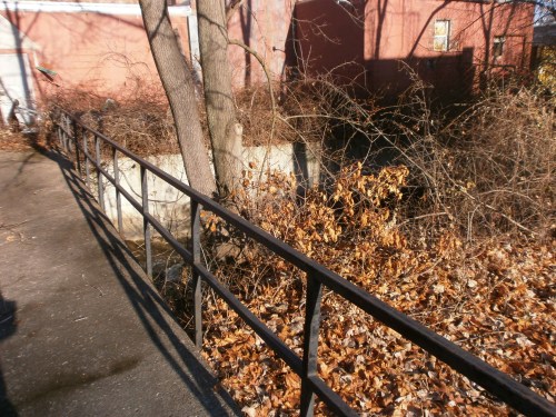
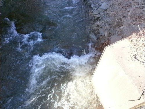
PHOTO 2 – The footbridge behind 44 Tivoli St. looking east toward the Hudson River.
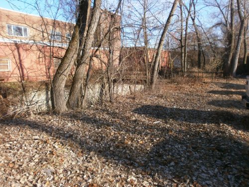
PHOTO 3 – From the footbridge behind 44 Tivoli St. looking west (upstream).
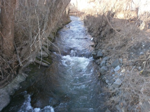
PHOTO 4 – From the footbridge behind 44 Tivoli St. looking east (downstream).
The next identifiable feature in the path to the river are two Erie Canal-era culverts that allowed the creek to flow under the canal as they now do under Erie Blvd. The culverts are behind locked “chain link” fences and are covered with perforated steel plates – thus, they are not visible. They are immediately adjacent to National Grid area and Huck Finn’s Warehouse, 25 Erie Blvd.
Culvert #1 – west side of Erie Blvd. – see map https://www.google.com/maps/@42.6614229,-73.7411599,3a,75y,291.62h,102.28t/data=!3m6!1e1!3m4!1sqbqtplEI2q36VpAeuBE2vQ!2e0!7i13312!8i6656
Culvert #2– east side of Erie Blvd. – see map https://www.google.com/maps/@42.6613315,-73.7412178,3a,75y,137.06h,76.54t/data=!3m6!1e1!3m4!1sUBvjA2WBOtlukpC5ggRY-g!2e0!7i13312!8i6656
Photo 5A – Culvert #1 – west side of Erie Blvd.
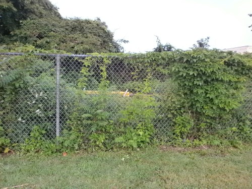
Photo 5B – Culvert #1 – west side of Erie Blvd.

Photo 6A – Culvert #2 – east side of Erie Blvd.
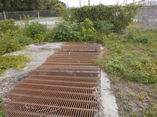
Photo 6B – Culvert #2 – east side of Erie Blvd.

On Google maps, following easterly along Manor St. from the Tivoli St.-Pleasant St. tree line shading Patroon Creek and then crossing Erie Blvd. (once the path of both the original [“Clinton’s Ditch”] and the enlarged Erie Canal) at the site of the above culverts, brings one to the mouth of the creek where it empties into the Hudson River. – see map https://www.google.com/maps/dir/42.659469,-73.7382589//@42.6594736,-73.7385021,261m/data=!3m1!1e3!4m2!4m1!3e1 at about 2,800 ft. from the above footbridge over Patroon Creek.


Great work. There’s a wealth of information in Albany’s institutions. Here’s a map showing Patroon Creek in 1895, coming in from the west and disappearing into the sewers and culverts at North Pearl, then down Broadway to Livingston and on the the river.
very helpful to those of us who haven’t gotten to these sections – thanks
a look after a major rainstorm would also be helpful, to see if the culvers are adequate. — or perhaps needing work.