
Introduction – The Capital District Transportation Committee’s Capital District Trails Plan envisions a network of core trails for the capital region. The Patroon Greenway, connecting the Albany Waterfront to the Albany Pine Bush Preserve, is one of six core Albany County trail components of that planned network.
Other better known core trails include the Albany County Helderberg-Hudson Rail Trail, the South End Bikeway Connector and the Mohawk-Hudson Bike-Hike Trail.
The initial detailed proposal for the Patroon Greenway done by the Capital District Transportation Committee in 2004 is available on their website and is linked at the end of this document. Over the past sixteen years there has been no significant progress toward making this trail a reality. Three recent developments make this an ideal time to take a good look at this project: the recently funded Albany County Skyway and the newly completed Patroon Creek Daylighting, and the installation of wayfinding signage on the existing Six Mile Waterworks trail.
The Ride – On Sunday August 30,2020, Aaron Corman, Glenn Sandberg, Ed Brennan, Mark Maniak, Rob Carle and Shelly Nevard met up at Quackenbush Square to review the potential for a city street route from the forthcoming Albany Skyway to the Patroon Creek Greenway. The Albany Skyway will provide cyclists and pedestrians a bridge over I-787 from the waterfront and the Corning Riverfront Park section of the Empire State Trail to Broadway next to Quackenbush Square and the Albany Visitors Center. Our initial destination was Tivoli Lake Preserve which was the endpoint or our Patroon Creek Greenway I ride in November 2019. That ride began at Six Mile Waterworks.
The Skyway plan is show below. It would take a little used ramp from Quay Street by the waterfront over I-787 to where it merges with a ramp from Southbound I-787 to connect to Broadway at the base of Clinton Avenue.

The picture below shows where this ramp meets Broadway. The right lane of the ramp (left side of photo) would be limited to pedestrians and cyclists. An Albany Planning Department employee recently remarked that cyclists would be expected to walk their bikes over the Skyway.

We crossed Broadway and continued up Clinton Avenue two blocks to Ten Broeck Street. Note there are currently no bike lanes along this section of Clinton. The Clinton bike lanes begin at Ten Broeck. It was suggested by the Planning Department that improvements to this area might bring bike and pedestrian accommodations to these last two blocks. Hopefully, that will mean the Clinton bike lanes will be continued to Broadway. It is interesting to note that there are also plans underway to improve Federal Park which is on the North side of Clinton between Broadway and Pearl. These improvements along with the Skyway can be expected to bring significant increases in foot and bike traffic. This block is shown below from the perspective of Clinton and Broadway. Clinton is certainly wide enough for bike lanes if there is the will to disrupt current traffic patterns.

The group turned right on Ten Broeck Street which has bike lanes until it meets Livingston Avenue. Note the car parked in the bike lane. Many Albany drives assume bike lanes are in fact an invitation to double park.

When Ten Broeck crosses Livingston it becomes Manning Blvd and the bike lanes cease. We continued along Manning. We found this part of Manning to be a wide quiet street with a gentle curving incline up toward our destination. The green roofed public housing we passed on Manning is shown below.

The hill up Manning is shown below. There appears to be plenty of room here for bike lanes. A pedestrian bridge overpasses Manning. It provides a connection from Colonie Street. We do not know if the bridge permits bikes.

Arbor Hill Park is shown on the left of Manning below and Lark Park on the right. It should be noted there are instances of diagonal parking along Manning that could be hazardous to cyclists. One such spot is partially shown below.

Bike lanes (aka parking lanes to many) resume where Manning Crosses Lark Street. These bike lanes also provide a buffer zone between cyclists and traffic.

As Manning approaches the Route 9 overpass, it becomes Northern Blvd. The buffered bike lanes continue.

It is interesting to note that after crossing Route 9 the buffer zone switches from providing space between cyclists and traffic to protecting cyclists from the door zone of parked cars.

We followed Northern Blvd to where another small disconnected section of Manning Blvd. provides access to the Tivoli Lake Preserve. The intersection of this Manning Blvd and Northern Blvd is shown below. The old Livingston High School (now apartments) is in the background. Kipp Tech Valley Middle School (not shown) is on the right.
This section of Manning ends where two gravel trails begin in Tivoli Park. One trail goes to the newly “daylighted” Patroon Creek. A photo of that trail from our November ride is shown below.

The other trail is being rehabilitated and not yet reopened. It goes through the park, around the lake and exits on Livingston Avenue near Ontario. Unfortunately, it was recently announced this trail is to be limited to foot traffic. This policy would need to be changed and that trail widened if Tivoli Park were to be used as a bike connection to Livingston Avenue as discussed below.

The second leg of our Patroon Creek Greenway Ride II explored on street options from the Livingston Avenue Tivoli Park entrance by Ontario to Everett Rd. The original CDTC Patroon Creek Greenway plan from Everett Road to Tivoli Park required large capital expenditures – especially the need to build a cantilever bridge along I90 and improve an old railroad bridge to cross the RR tracks. There will also be safety issues to contend with due to the proximity of the railroad tracks and high speed Amtrak trains. To make the Patroon Creek Trail happen in the nearer term, there will need to be some interim on road sections.
Our group rode around Tivoli Park and down Livingston Avenue noting the Livingston Avenue parking lot as one possible exit of a path thru Tivoli Park as well as the currently gated exit by Livingston near Ontario Street. The latter path exit is shown below.

We continued west on Livingston Avenue for about a block and turned right on Terminal Street. Livingston Avenue is a fairly busy road with no bike lanes. Terminal Street did not appear busy, but our ride was held on a Sunday. This is the start of an industrial/warehouse area that can expect to have some truck traffic.

There is also a hill on Terminal Street leading down to Commerce Avenue where we turned left. The hill on Terminal Street is shown below. It should be noted that the existing road did not appear wide enough to support bike lanes. On street parking did not appear to be an issue. Using Manning to connect to Commerce as an alternative would encounter much more on street parking and perhaps more traffic.

Along Commerce Avenue we noted the spot where the famous Engine 999 was constructed, “the first creation of man in the history of time to travel achieve 100 miles per hour”!

We also explored Industrial Park Road looking for access to the existing Patroon Creek Trail by way of the I90 railroad underpass, but found access blocked by fencing at the CDTA complex. During last November’s ride we found this potential part of the trail was very close to the rail tracks and the space for a bike path under I90 was very narrow. We think the railroad would object to the trail here. At the very least, fencing of some sort separating bikes and pedestrians from the rails would be required.

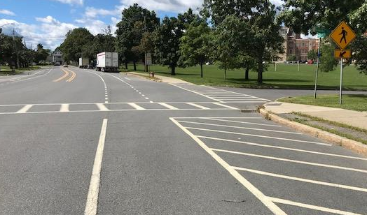
We continued west down Commerce Avenue, which becomes Watervliet Avenue before it ends at busy Everett Road. Commerce and Watervliet Avenue appeared wide enough to support bike lanes. While I do not recall prohibitions against on street parking, none was observed. Our ride conference at Everett Road is shown below shortly before we headed back to our starting point. Our consensus was that our modified on street/Tivoli Park Trail Patroon Creek Route would need to meet up with the remainder of the Patroon Creek Trail at Everett Road.

As noted in the analysis of our November 2019 ride, the original Capital District Transportation Committee studies imagined that the Patroon Creek Trail will go under Everett Road between I-90 and the train tracks. The CDTC study provided accessibility of the trail to and from Everett Road via construction of a “Dutch Stair”. We also noted that significant signaling improvements would be needed on Everett Road to permit safe pedestrian and bike travel to cross the I90 ramps. The cost of the Dutch stair and traffic signaling are probably the greatest hurdles to connecting our modified route to the rest of the Patroon Creek Trail running from Everett Road to Fuller Road. The political issues around disrupting motor vehicle traffic flow are also significant.
The arrow in the picture below shows imagined ped/bike travel along the sidewalk of Everett Road from the area where the Dutch stair would come up from the Patroon Creek Tail below. The “S” marks show where signaling improvements would be needed to permit safe ped/bike crossings of the I-90 ramps. Bikes would likely need to be walked and/or the sidewalk significantly widened.


In the original CDTC Study, the Patroon Creek Greenway Trail passes under Everett and continues on north side of I-90 south of the railroad tracks. It then uses a cantilever bridge along the north side of I-90 to cross the railroad tracks. It would then cut back under I-90 using Anderson Rd. An approximation of this route is shown below.
From Anderson Road the CDTC Plan envisions crossing the railroad tracks by redeveloping an abandoned railroad trestle to a point near the Freihofer (now Bimbo) Bakery site. Here it is also not far from the Tivoli Park Patroon Creek Daylighting Trail as shown below. The Cantilever Bridge and rail trestle rehabilitation envisioned in the original CDTC plan would also require large capital expenditures that would greatly increase the costs of the Patroon Creek Greenway. Such costs are over and above significant costs of acquiring rights to and improving the lengthy trail itself.

Conclusion – The forthcoming Albany Skyway and Patroon Creek Daylighting project provide a singular opportunity to kick off a campaign for the long dormant Patroon Creek Greenway plan that has been collecting dust in CDTC’s archives. COVID has also led to a substantial increase in the number of people turning to cycling and trail hiking as a safe means of getting exercise and enjoying the out of doors. The long awaited South End Connector has also contributed to rising local trail use for those that have access to it. It is great that the Patroon Creek Daylighting Project and the other Tivoli Lake Preserve trail rehabilitation we saw will provide such recreational access to Albany’s West End and Arbor Hill citizens. Connecting the Albany Skyway and Patroon Creek Daylighting project could be phase I of the larger Patroon Creek Greenway. It would not only open up Tivoli Lake Preserve to a great many more Albany area citizens, it will also provide a safe bike route for West End and Arbor Hill citizens to the waterfront, the downtown theater district, the Empire State Trail/Mohawk-Hudson Bike-Hike Trail and the Albany County Rail Trail.
It is appears that the heaviest lifting for making the whole Patroon Creek Greenway Trail a reality lies in the middle section from Everett Road to west end of Tivoli Lake Preserve. This section involves major expenditures to make Everett Road accessible from the trail and safe for pedestrians and cyclists. Those improvements may also run head on into competing interests of motorists. The original CDTC plan also entails major capital outlays for a cantilever bridge along I90 and rehabilitation of a railroad trestle. The on street alternative route from Tivoli Park to Everett Road that we explored would also require spending for bike/ped accommodations along a short section of Livingston Ave, Terminal Street and Commerce Avenue-Watervliet Extension. The project can expect resistance on this section from motorists, especially those concerned with trucking. Limiting parking on the block of Livingston from Ontario to Terminal would also impact some residents. We believe the economic costs and political battles that would need to be won to bring about either the original CDTC plan or a modified on street plan requires putting off this section of the Greenway for a later stage.
The section of the trail from Everett Road to the Six Mile Waterworks also has challenges. Providing safe access to the west end of the trail from Six Mile Waterworks across Fuller Road and its traffic circle at the I90 interchange will be difficult. It will likely require costly traffic engineering and signaling changes and result in some motor traffic disruption. As noted in our November report there was no traffic circle when the original CDTC traffic study was done. Ownership issues for a new trail from the Circle to the start of the trail behind Ultrapet will need to be studied. A crossing signal for where the trail crosses Central Avenue will also likely be required. While it appears much of the trail over this section is subject to various public utility easements, there will need to be some coordination to formalize a public bike-hike trail. The recent local success of building the Albany-Hudson Electric Trail over such a public utility right of way gives us reason to believe this can happen.
If the first stage of the Greenway outlined above can be achieved, we are more likely to find the political will to find funds and take on competing interests for other stages of the Greenway. Since the section from Everett Road or at least Central Avenue to the Six Mile Waterworks is less costly in terms of capital and political costs, this might be considered for a second stage. The heavy lift from Everett Road to Tivoli Park may have to wait until other ends of the trail are in use and demand exists for the costly connector in between. The South End Connector is an example of how this process might successfully develop.
Maps
Proposed Stage 1 Hudson River/Skyway to Tivoli Lake Preserve

Proposed Stage 2a Six Mile Waterworks to Central Avenue at Yardboro Avenue

Proposed Stage 2b Central Avenue at Yardboro Avenue to Everett Road

Proposed Stage 3 Everett Road to Tivoli Lake Preserve

Prior Albany Bicycle Coalition Reports
· Downtown Albany and Patroon Creek https://albanybicyclecoalition.com/2020/02/03/downtown-albany-and-patroon-creek/
· Patroon Creek Greenway Trail Ride https://albanybicyclecoalition.com/2019/12/11/patroon-creek-greenway-trail-ride-11-19/
· Patroon Greenway Project – Yardboro Ave. to Everett Rd. https://albanybicyclecoalition.com/2019/11/23/patroon-greenway-project-yardboro-ave-to-everett-rd/
Capital District Transportation Committee Studies
+++++++
Patroon Project Flyer – The City of Albany Planning Office issued the following Patroon Project flyer in 2021:


![Fuller-To-Central-Section[1]](https://albanybicyclecoalition.com/wp-content/uploads/2019/12/fuller-to-central-section1.jpg) We started across at Six Mile Waterworks Park. We crossed used the crosswalk north of the circle to get access to the Ultrapet parking lot and the beginning of the trail. At the time of the Patroon Creek Studies (2004 – note at end of this report), there was a traffic light at this location. This is now less navigable for bikes and pedestrians.
We started across at Six Mile Waterworks Park. We crossed used the crosswalk north of the circle to get access to the Ultrapet parking lot and the beginning of the trail. At the time of the Patroon Creek Studies (2004 – note at end of this report), there was a traffic light at this location. This is now less navigable for bikes and pedestrians.![I-90-Underpass-C[1]](https://albanybicyclecoalition.com/wp-content/uploads/2019/12/i-90-underpass-c1.jpg) The Study imagines that the trail will follow north side of I-90 and along a cantilever bridge to cross the railroad tracks. It would then cut back under I-90 using Anderson Rd. The Study trail would then use redeveloped abandoned rail trestles to cross back over the tracks to a point near the Freihofer (now Bimbo) Bakery site. Note the pointer to Anderson Rd at the top of the picture below. Everett is at the bottom.
The Study imagines that the trail will follow north side of I-90 and along a cantilever bridge to cross the railroad tracks. It would then cut back under I-90 using Anderson Rd. The Study trail would then use redeveloped abandoned rail trestles to cross back over the tracks to a point near the Freihofer (now Bimbo) Bakery site. Note the pointer to Anderson Rd at the top of the picture below. Everett is at the bottom.

![Tivoli-Trail[1]](https://albanybicyclecoalition.com/wp-content/uploads/2019/12/tivoli-trail1.jpg) It should be noted that the Study anticipated the rest of the bike route from Tivoli Park to the Corning Trail would be by City Streets. The author thought the options of a) following the deep railroad ravine or b) cantilevering along I-90 would be too costly and would not provide significant advantages for neighborhood users. Here I believe the Study’s proposed route could be adjusted to use some of Albany’s few improved bicycle friendly roads and other improvements following Northern Blvd to Manning to Ten Broeck to Clinton to the “To Be Repurposed” 787 Ramp to the Hudson/Corning Trail.
It should be noted that the Study anticipated the rest of the bike route from Tivoli Park to the Corning Trail would be by City Streets. The author thought the options of a) following the deep railroad ravine or b) cantilevering along I-90 would be too costly and would not provide significant advantages for neighborhood users. Here I believe the Study’s proposed route could be adjusted to use some of Albany’s few improved bicycle friendly roads and other improvements following Northern Blvd to Manning to Ten Broeck to Clinton to the “To Be Repurposed” 787 Ramp to the Hudson/Corning Trail.![Dutch Stairs[1]](https://albanybicyclecoalition.com/wp-content/uploads/2019/12/dutch-stairs1.png)


