
Mayor Sheehan and the City of Albany promised. Mayor Sheehan and the City of Albany delivered – the South End Connector
NOTE: The Connector officially opened on 7/7/20. Please see City of Albany 7/7/20 News Release at the end or this post.
After many years of work, the South End Connector is “99 and 44/100 percent” done. Contractors have completed all the heavy construction work. There remain many finish-up projects, but the route is open and usable at this time.
COVID-19 Alert – If you are planning to visit the South End Connector or the connecting trails, please observe appropriate precautions for your safety and that of others.
This article presents photos of the completed project, suggests enhancements, calls for some corrective action, and describes what Albany Bicycle Coalition has done and is doing.
Photo 1 – Westbound entrance to the South End Connector under I-787 at Broadway and Quay St.
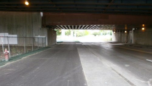
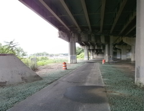
Photo 2 – View of Connector looking South from under 787 at Broadway.
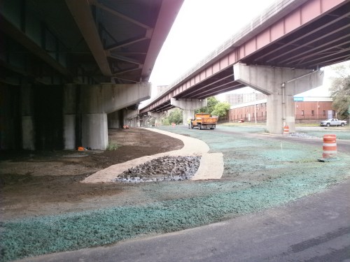 Photo 3 – Closer view of drainage ditch installation with the multiuse pathway and Church St. in the background.
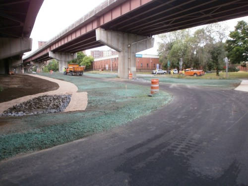 Photo 4 – Church St. now one-way going South with the Connector coming out from under 787. This is the one “pinch point” that required adjusting a lightly used motor vehicle in order for the Connector to avoid the concrete support for 787.
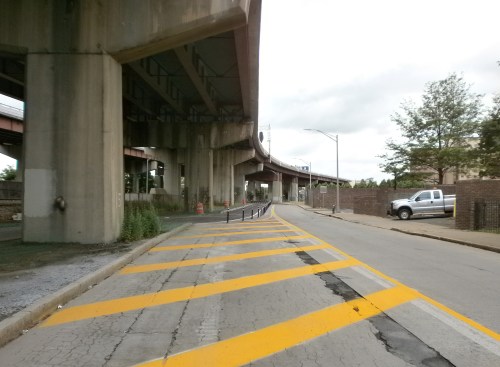 Photo 5 – Connector straight ahead looking south.
 Photo 6 – Church St. swinging off west into Bassett St.
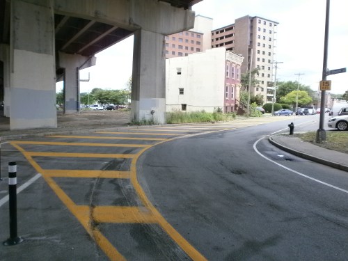 Photo 7 – Straight path south under 787 with intersection with Vine St./Church St. and with cycle track and rail yards coming up in the background.
 OVERVIEW – In 2013, theAlbany Bicycle Coalition (ABC)joined with the Revitalize Our Waterfront (ROW) group to plan, promote, and design a connection between the soon-to-be-completed Helderberg Hudson Rail Trail and the long-established Mohawk-Hudson Bike-Hike Trail. We recognized that the 1.5-mile gap with heavy urban traffic on S. Pearl St. would be a barrier to experienced riders but even more so for recreational or novice cyclists. ABC and ROW conducted rides of the proposed trail, attended innumerable meetings, posted project updates, conferred with neighbors, gathered support from residents and others, and submitted proposals for route design.
Here’s a March 2015 chilly ride to explore the proposed South End Connector – 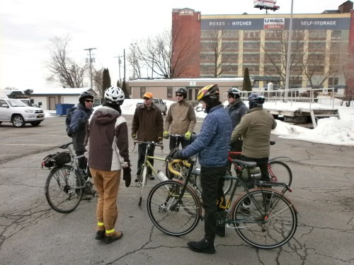
We also recognized that a neighborhood bicycle route would support those who rely on their bicycles for mobility – jobs, school, heath care, family. It would help make the “south end” a livable community. From a recreational standpoint, connecting the Helderberg Hudson Rail Trail and the neighborhood to the waterfront and Corning Riverfront Park would ameliorate the downside of I-787 and provide pleasure to many.
Photo 8 – Looking North at the intersection of the Connecter with Vine St./Church St. showing construction in process. At this point, people on bicycles can head right or east on Church St. toward the Hudson River to access Broadway, the Port of Albany, and the City Island Park. City Island Park can serve as a starting point for riding the South End Connector Bikeway.
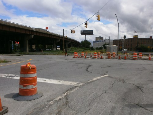 Photo 9 – Another view of the Frontage Rd. with the Connector crossing Church St. and going to the left and then right-north under 787.
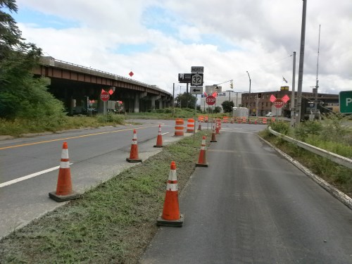 Photo 10 – Beautiful median with newly planted trees and shrubbery on the left separating the Connector from the rail yards.
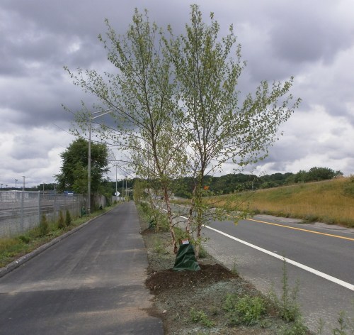 Photo 11 – Tank Bombs are still there although currently few in number. They will be back as soon as Americans resume normal gasoline consumption, OPEC opens the plug, and Bakken Crude again becomes price competitive.
 Photo 12 – Intersection of the Connector track with S. Pearl St. on the right. Heavy trucks much in evidence speeding along S. Pearl St.
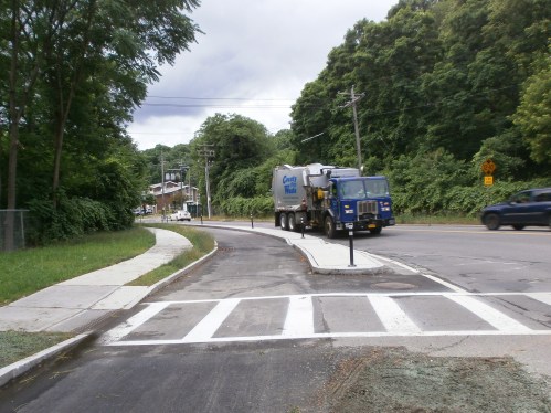 Photo 13 – Two-way cycle track heading south toward the trailhead for the Helderberg Hudson Rail Trail.
ENHANCEMENTS – Here are enhancements and safety issues that ABC believes the South End Connector needs. While many of these may already be on the city’s agenda, our goal is to help ensure that nothing is left out. ABC members have observed the Connector over its entire length and studied it for several years. While the newly completed pavement is a giant step forward, several locations need additional work for safety and wayfinding.
Here are specific areas needing attention:
- Quay St./Broadway Intersection at USS Slater/Dutch Apple – Large, busy, hazardous intersection. Bicyclists coming south on the waterfront bike lanes cannot see the South End Connector since it is diagonally across the intersection under I-787. New, more prominent wayfinding signs, a map, and green pavement markings, would bring riders from the waterfront to Connector without riding in the street.
- Obsolete “Bike Route” Sign – Church St. at Rensselaer St. The sign points west towards Pearl St., and thus directs riders away from Connector. Now that Connector is functional, the old route sign will confuse people on bicycles. They should be blocked off and then replaced.
- Security Lighting Under I-787 – The long S-curve north of the Church St. intersection is very isolated and cannot be seen from street. Ideally, there would also be security cameras.
- North End of I-787 Service Road at Church St. – Crosswalk/bikeway needs to be marked on the pavement (after the street completed).
- Raised Barrier – At 700 S. Pearl St., a painted oval was recently added. However, cars still pull into this space to discharge passengers. The virtual barrier is ineffective. If the city cannot install a barrier in a timely manner, it should place at least a “No Parking” or “No Standing” sign.
- S. Pearl St. Parking Lot – Entrance from the cycle track needs stop signs for southbound riders entering the Helderberg Hudson Rail Trail parking lot as cars may be exiting from or entering into it. Need a map of the Connector adjacent to path.
Photo 14 – What a relief to be separated from speeding, gigantic, roaring trucks tailgating people on bicycles.
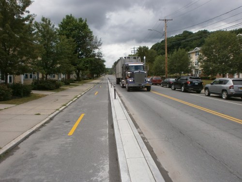 Photo 15 – Cycle track entrance from the Helderberg Hudson Rail Trail trailhead/parking lot. Note nice concrete barriers.
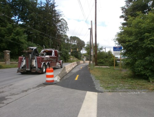 Photo 16/17 – What’s that name again? (Officially it’s “South End Connector“)
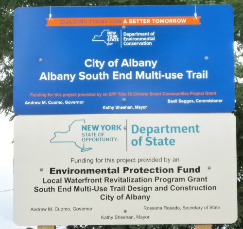 Photo 18 – Riders coming off the rail trailhead protected by “Jersey Barriers.”
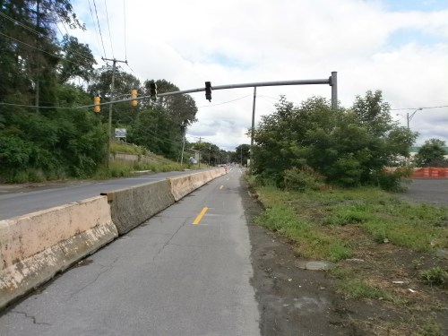 Photo 19 – Cycle track in front of the Center for Disability Services with curbing and plastic bollards separating it from the travel lane.
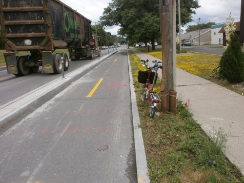
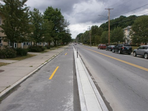
Photo 19A – Lane markings on S. Pearl St.
 Photo 20 – Exiting S. Pearl St. portion of cycle track and entering the frontage road cycle track on the right. Note CDTA bus stop. Yield to those pedestrians!
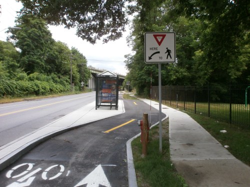 Photo 21 – Swinging onto the cycle track. S. Pearl St. going under 787 to Rt. 9W and the Thruway interchange. Those people on bicycles wishing to go directly downtown can continue on S. Pearl St. and not enjoy banging over the cursed Belgian Blocks at the intersections. The free, interactive BikeAlbanyMap is a helpful tool for navigating from the Connector.
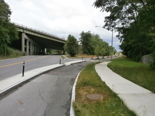 Photo 22 – Stanchion for trail lighting.
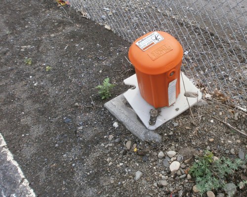 Photo 23 – Good drainage!
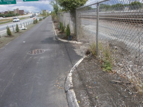 Photo 24 – Looking south for another view of workers at the Church St. cycle track traffic island. Connector exit/entrance on the lower left. Obey that STOP sign! At this point, people on bicycles can stay on road to the right and pass under 787 to access Green St. and the neighborhood.
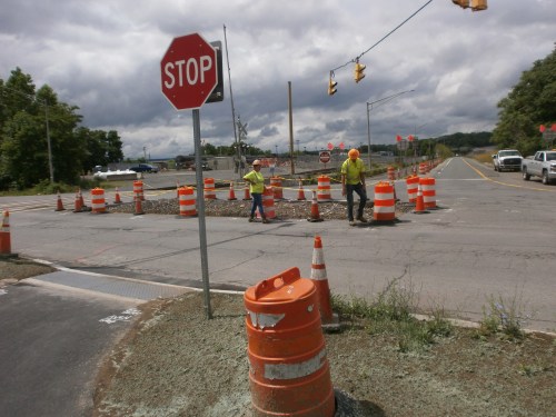 Photo 24A – Beginning of S curve leading to under-787 segment at Vine St./Church St.
 Photo 25 – Planting grass.
 Photo 26 – Some work still to be completed. Note construction equipment and staged materials.
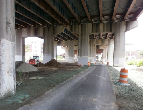
Photo 26A – The long S-curve north of the Church St. intersection is isolated and cannot be seen from street.
 Photo 27 – Looking north on Church St. that is now one way southbound. The cycle track swings out into the former travel lane. This is the one “pinch point” in the entire project. Again, people on bicycles can exit the Connector and access the neighborhood via Bassett St. See the BikeAlbanyMap.
 Photo 28 – Virtual street lighting?
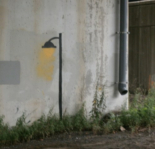 Photo 29 – Approaching the north terminus of the Connector, the path turns hard right to the east and becomes 12+ feet wide. It goes under 787 toward the Dutch Apple/Slater mooring. Broadway traffic zooming in from the left. At this spot, a SUV struck and killed 60-year-old cyclist Jose Perez on 8/3/06.
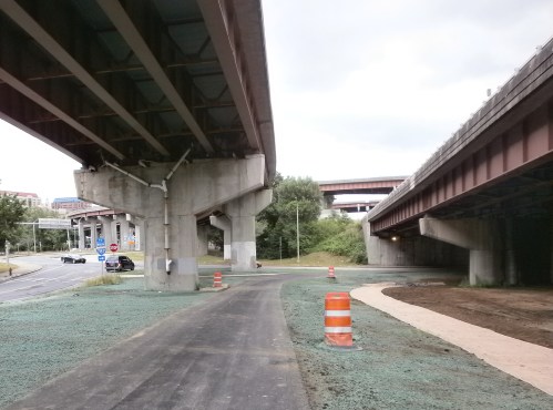 Photo 30-33 – Looking east toward the River with Broadway swooping off to the right/south. When people in cars turn right onto Broadway they will be coming up on the bicycle rider’s blind side. The only traffic control is a (meaningless) yield sign – where it is clear to a driver that there to no motor vehicle traffic to which to yield. More demonstrative traffic control needed here. (No, that’s not a crossing guard standing under the green interstate-style sign in the first photo.)
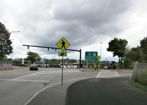
Many people on bicycles will be using the Helderberg Hudson Rail Trail, South End Connector Bikeway, and Mohawk-Hudson Bike-Hike Trail because THEY ARE NOT PREPARED OR WILLING TO COPE WITH motor vehicle traffic. Between Voorheesville and the 4th and Broadway trailhead in Watervliet, cyclists do not have contend with on-road motor vehicle traffic except at this Broadway/Quay St. point. That is, 32 miles round trip without motor vehicle interaction (other than crossings).


Photos 34 – The South End Connector Bikeway and Helderberg Hudson Rail Trail are feeders to the Empire State and Erie Canalway trails as they merge into the Mohawk-Hudson Bike-Hike Trail.
Just think – Voorheesville to Buffalo!
For earlier, in-process reports and photos on the South End Connector Bikeway go here.
++++++
Here is the City of Albany news release on the 7/7/20 “grand opening” ribbon cutting:
CITY OF ALBANY – OFFICE OF THE MAYOR – 24 EAGLE STREET – ALBANY, NEW YORK 12207
* * NEWS RELEASE * *
Date: July 7, 2020, Contact: David Galin, dgalin@albanyny.gov
Albany Mayor Kathy Sheehan and Partners Announce Opening of South End Bike/Pedestrian Connector
ALBANY, NY – Mayor Kathy Sheehan joined state and local partners to unveil the highly anticipated South End Connector, a $1.7 million project that links the Mohawk Hudson Hike-Bike Trail to the Albany County Helderberg-Hudson Rail Trail along the Hudson River. The trail creates the City’s first physically separated two-way cycle path – a safe, attractive, and environmentally friendly corridor for pedestrians and cyclists to travel between these two bike and pedestrian trails.
Mayor Sheehan also announced the kick-off of Phase Two of the project – which will engage the South End community and others in finding ways to make the space surrounding the South End Connector underneath Interstate 787 more attractive and engaging to the public.
About the South End Connector – The 1.5-mile South End Connector features the first physically separated two-way cycle track in the City. The trail is protected by a landscaped buffer from the Albany County Helderberg-Hudson Rail Trailhead to the Interstate 787 Frontage Road. At Church Street, the protected trail continues underneath Interstate 787 for a walk or ride all the way to the Mohawk Hudson Hike-Bike Trail connection. The South End Connector also provides traffic calming measures along South Pearl Street, slowing traffic and creating a direct route for the residents of the South End to access Corning Waterfront Park.
The South End Connector is also a part of the Empire State Trail. When completed by the end of 2020, the Empire State Trail will be a continuous 750-mile route spanning the state from New York City to Canada and Buffalo to Albany, creating the longest multi-use state trail in the nation.
South End Connector Phase Two Launched – Phase Two of the project seeks to activate the space underneath Interstate 787. The City’s Department of Planning & Development and consultants Creighton Manning and Landing Studio will be conducting outreach to the public in the fall of 2020, finalizing a design over the winter, and planning construction in 2021. The City hopes residents and visitors will use their imaginations to propose ideas for making this area more attractive and for amenities that would make their experience more enjoyable.
Partnerships and Funding –The City of Albany would like to thank the many project partners who helped bring this trail from Feasibility Study through Construction. The South End Connector is a model example of how Governor Cuomo’s Consolidated Funding Application can be leveraged to create State and Local partnerships that result in high quality infrastructure that increases our residents’ quality of life. This project was made possible through funding from the Capital District Transportation Committee, New York State Department of State, New York State Department of Environmental Conservation, New York State Assemblymember John McDonald, and New York State Assemblymember Patricia Fahy.
Albany Mayor Kathy Sheehan said, “When we started this project, I asked that we explore all the potential of this important bike and pedestrian connector – and this project has done just that. We’ve created the City’s first physically separated two-way cycle trail – a corridor that will make it safer and more environmentally friendly for residents and visitors alike to travel between Albany’s South End and Corning Preserve. Thank you to each of the state and local partners, including area residents, who have come together to plan and deliver this important addition to our City. I very much look forward to working with South End residents and others in the region on Phase II.”
New York State Senator Neil Breslin said, “The South End Connector bike trail will increase access to green space, reduce pollution and enhance the South End neighborhood. I applaud the City of Albany, Assemblymembers Pat Fahy and John McDonald and their many partners for an initiative that promotes outdoor activities and connects our communities.”
New York State Assemblymember John McDonald said, “The completion of Phase One of the South End Connector provides a guide toward creating a more accessible city that can be enjoyed by residents in this region and throughout the State. I encourage everyone to take advantage of this two-way cycle track to explore our communities. I am happy to have been able to dedicate funding to this project and I look forward to the competition of Phase Two in the near future!”
New York State Assemblymember Patricia Fahy said, “Capital Region residents and visitors alike will now have the opportunity to utilize what is now a 32-mile paved and uninterrupted bike-hike path. I am proud to have helped secure state funding for the South End Connector project, which will help to drive increased foot traffic and mobility in and around downtown Albany and our waterfront. Multi-use trails drive consumers to our locally owned small businesses, produce multiplier effects for the communities they run through, and ultimately help encourage alternative modes of transportation – helping to reduce our collective carbon footprint. Moreover, I am pleased this long-identified gap in our regional trail system has finally been closed – priming it for the completion of the Empire State Trail slated for this year.”
Department of Environmental Conservation (DEC) Commissioner Basil Seggos said, “DEC’s Climate Smart Communities Grant Program is making significant investments statewide to help local governments join New York’s nation-leading efforts to fight climate change and build healthy, resilient, and equitable communities. DEC is proud to be a contributing partner in the City of Albany’s new connector trail, a project that helps advance multiple goals by reducing greenhouse gas and other harmful emissions and increasing public access to green space for the South End community.”
New York State Secretary of State Rossana Rosado said, “The Department of State is proud to support the completion of the South End Connector Trail in the City of Albany through the Local Waterfront Revitalization Program. In the current pandemic, we’ve seen the critical role parks, trails, and open spaces play in overcoming social isolation and bringing people together outdoors at a safe distance. The South End Connector Trail is an integral link to the Empire State Trail, which is connecting New Yorkers and enhancing outdoor recreation and community vitality across the state.”
Capital District Transportation Committee Executive Director Michael Franchini said, “It is extremely rare to see a transportation planning study implemented so quickly. This CDTC study, which was sponsored by the City of Albany, was completed in December 2017. In that short 2 ½ year period funding was obtained, and design and construction was completed. It is a real tribute to all the stakeholders, including the City, New York State, and the neighborhood; and to their incredible cooperation.”
###


