
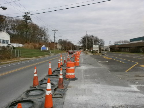
Here are today’s views of progress on the South End Bikeway Connector. The first shows a major step completed at the southern end of the Connector – curbing for the cycle track installed with the concrete curing under protective cover. Remaining steps include paving the bicycle area, installation of “protective ‘plastic’ bollards,” and striping.


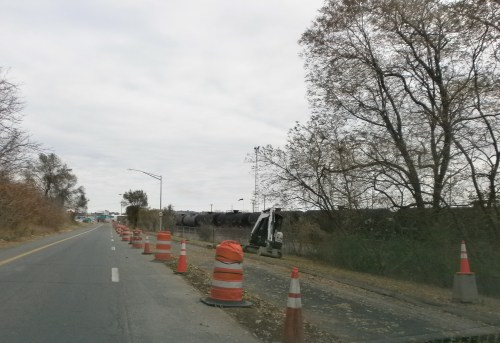
Next, a northerly view of Frontage Rd. along 1-787 showing the shoulder and one motor vehicle lane converted to a cycle track. The excavation is complete almost to Church/Vine Sts. Looking south from Church/Vine Sts. showing cut marks in the pavement and the progress on excavations from S. Pearl St. up to the construction vehicle in the distance.


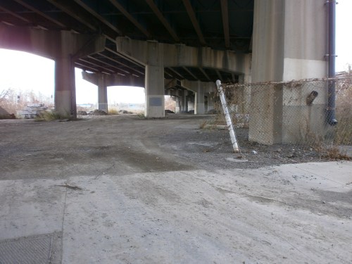
The soon-to-be linear park and off-road multiuse path under I-787 now being used as a construction staging areas – note piles of soil, rock, and granite curbing (to the left).
A South End Bikeway Connector route description follows below. When completed, the SEBC will be the first Protected Bicycle Lanes in the City of Albany and the first bicycle lanes that actually connect up to other facilities – the Helderberg Hudson Rail Trail and the Mohawk-Hudson Bike-Hike Trail/Erie Canalway Trail/Empire State Trail. According to the City of Albany, construction on the SEBC will continue until the end of the 2019 construction season. With this additional 1.5 miles of bicycle lanes, Albany will have a total of 6 miles of bicycle lanes just in time for the 10 anniversary of the Albany Bicycle/Pedestrian Master Plan.
~ The South End Connector Bikeway Route Description ~
The bikeway begins at S. Pearl St./Old S. Pearl St. in the Helderberg Hudson Rail Trail trailhead and parking lot. Between Old S. Pearl St. and Mt. Hope Dr. and the Frontage Road (the I-787 northbound entry road), there will be a separated, on-street, two-way cycle track. (This two-way feature alleviates the need for people on bicycles to cross S. Pearl St.) The cycle track will continue onto the east/river side of the Frontage Rd. to Church St./Vine St. It will then briefly turn west before continuing on an off-road, 10-foot wide, multi-use trail and linear park underneath I-787 to Broadway and Quay St. To skirt the I-787 support structure, at the Church St./Bassett St. intersection the connector will be on-road until Rensselaer St. Here it again it will shift back off-road until the turn toward the Hudson River, the Slater and Dutch Apple mooring, and the Mohawk-Hudson Bike-Hike Trail/Albany Riverfront Park. To accommodate the connector’s path, Church St. from Rensselaer St. to Bassett St. will become a one-way southbound. Broadway currently consists of four travel lanes – two eastbound and two westbound. One lane on will be removed to construct the multi-use path on the south side of Broadway (where it passes under I-787), resulting in one westbound lane and two eastbound lanes.


