
Construction is fully underway on the long-awaited South End Bikeway Connector. [Photos from 10-26-19. For route description, go to end of this post.]
LOOKING NORTH – New CDTA bus stop at Mt. Hope Dr. People on bicycles will ride behind it and then veer off to toward the river and onto the cycle track on the I-787 northbound entry road.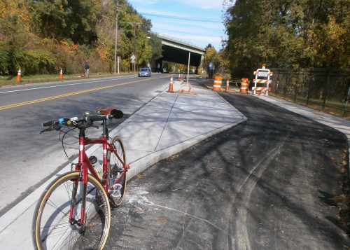 LOOKING NORTH – The new cycle track on Frontage Road, the I-787 northbound entry road leading to Church and Vine Sts. (“One lane taken form cars, one lane added for bicycles.”) (“Tank Bombs” very much in evidence.)
 LOOKING SOUTH TOWARD THE RAIL TRAIL – Cycle track replacing the eastside parking along S. Pearl St.

LOOKING NORTH – Cycle track under construction on east/river side of S. Pearl St. Note brave cyclist riding in the motor vehicle lane. There is no choice while the road is under construction. For orientation, note the blue and white Bennet sign to the west. Note pavement cut marks and compare final width shown in Photo #3 and 4.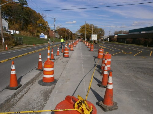 LOOKING SOUTH – Helderberg Hudson Rail Trail trailhead and parking lot is to the left just past the pylons.
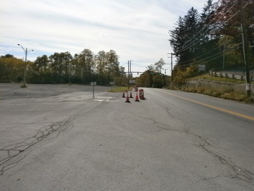
~ The South End Connector Bikeway Route Description ~
The bikeway begins at S. Pearl St./Old S. Pearl St. in the Helderberg Hudson Rail Trail trailhead and parking lot. Between Old S. Pearl St. and Mt. Hope Dr. and the Frontage Road (the I-787 northbound entry road), there will be a separated, on-street, two-way cycle track. (This two-way feature alleviates the need for people on bicycles to cross S. Pearl St.) The cycle track will continue onto the east/river side of the Frontage Rd. to Church St./Vine St. It will then briefly turn west before continuing on an off-road, 10-foot wide, multi-use trail and linear park underneath I-787 to Broadway and Quay St. To skirt the I-787 support structure, at the Church St./Bassett St. intersection the connector will be on-road until Rensselaer St. Here it again it will shift back off-road until the turn toward the Hudson River, the Slater and Dutch Apple mooring, and the Mohawk-Hudson Bike-Hike Trail/Albany Riverfront Park. To accommodate the connector’s path, Church St. from Rensselaer St. to Bassett St. will become a one-way southbound. Broadway currently consists of four travel lanes – two eastbound and two westbound. One lane on will be removed to construct the multi-use path on the south side of Broadway (where it passes under I-787), resulting in one westbound lane and two eastbound lanes.


